Portfolio of Undergraduate Work at Auburn University
Hello, welcome to my undergraduate portfolio. As a student at Auburn University, I learned that geography is not just about making maps or memorizing trivia nuggets, but a way of thinking about the world – of how location, distance, and place influence the problems that we humans face in the world. I learned about the field of GIS, and how spatial analysis allows us to visualize, analyze, and potentially solve these problems. On this page, I have provided samples of some of my coursework at Auburn.
Relevant Coursework
Cartography and Graphics • Geographic Information Systems • Aerial Photography and Remote Sensing • Advanced GIS • GIS Applications • Quantitative Methods and Spatial Analysis • Urban Geography and Sustainability • Human Water Resources • Statistics for Scientists and Engineers • SAS Statistical Programming • Calculus I-III
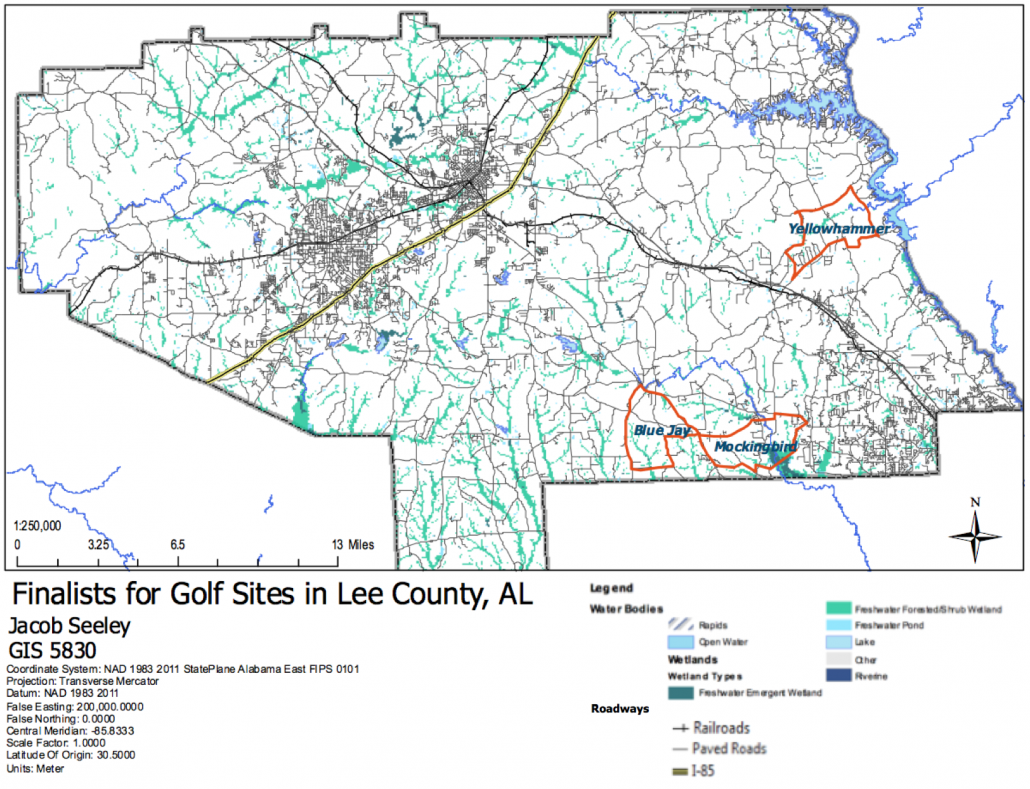
Selection of Sites for New Golf Course in Lee County, AL
Preview Image – Click for full report.
This project entailed identifying optimal areas for a hypothetical golf course in Lee County, Alabama, by working within a GIS framework. I utilized basic geoprocessing within ArcGIS and a waterfall method for project management. I completed this report for an introductory GIS course in the Spring of 2016.
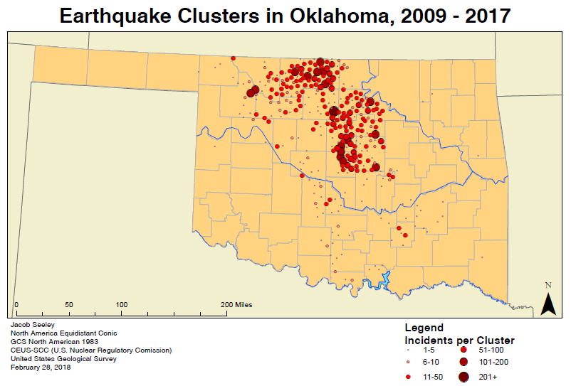
Cluster Detection of Induced Earthquakes in Oklahoma
Preview Image – Click for full report.
In this project, I mapped and identified clusters of induced earthquakes in Oklahoma, those associated with man-made activities such as hydraulic fracking and wastewater disposal. I then compared to distribution of recent earthquakes with the historic range of seismic activity in the state.
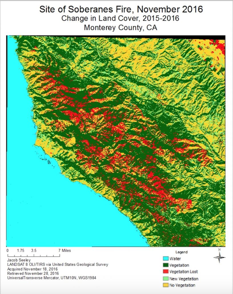
An Analysis of Vegetation Loss after 2016 California Wildfire
Preview Image – Click for full report.
In this project, I identified vegetation cover that had been damaged by the Soberanes Wildfire in Monterey County, California. Using ERDAS Imagine, ArcGIS, and LANDSAT 8 satellite imagery, I utilized remote sensing techniques to classify land cover change and analyze the spatial extent of the damage caused by the wildfire. I completed this project for a remote sensing course in the Fall of 2016.
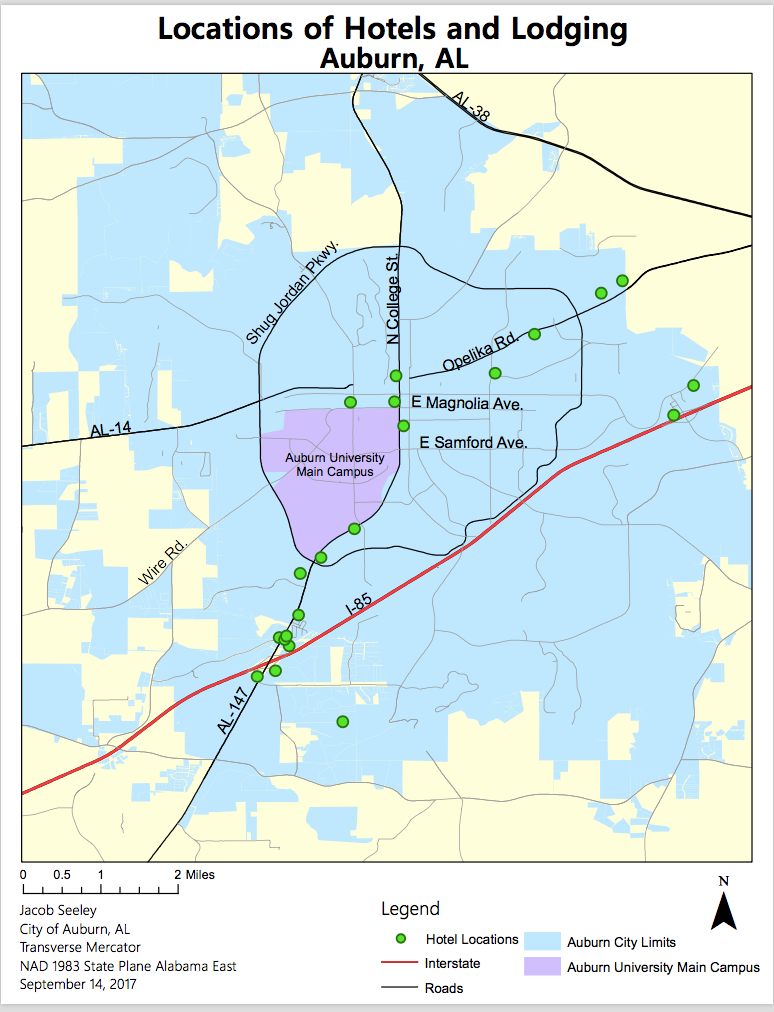
Location of Hotels in Auburn, AL
In this project, I mapped the spatial distribution of hotels and lodging within the city limits of Auburn, Alabama. I completed this project in the Fall of 2017, for a cultural geography course that examined how types of economic activity are influenced by the relationships between people and space.


